Cyclone Murasu Makes Landfall Near Ongole With Winds Gusting to 120 Kmph
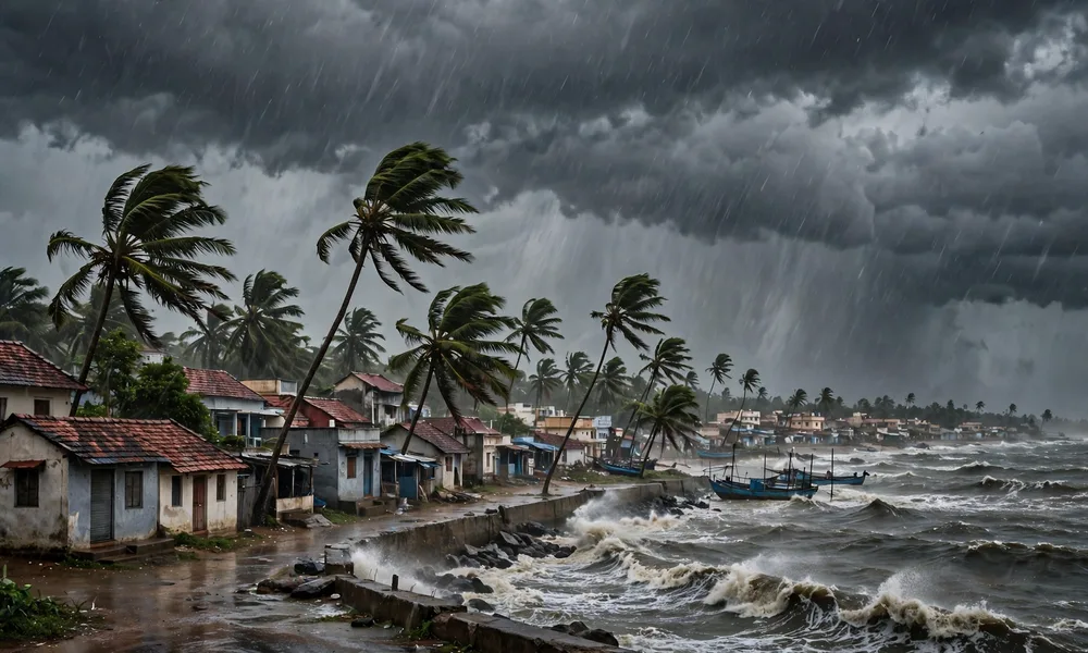
Severe cyclonic storm Murasu has crossed the Andhra Pradesh coast near Ongole, bringing powerful winds, heavy rain, and a dangerous storm surge to low lying coastal districts. The landfall process began at about 1 am Indian Standard Time on Tuesday, November 3, near Ongole in Prakasam district, between Nellore and Narsapur. The storm then crossed the coast between 3:30 am and 5:30 am, a period when wind, rain, and sea conditions were at their most intense for communities close to the shore.
Forecasters had tracked Murasu for days as it moved over the Bay of Bengal toward the Andhra coast. As it came ashore, sustained winds were reported at 100 to 110 kilometres per hour, with gusts reaching 120 kilometres per hour. Winds at that strength can tear off roofs, bring down trees and power lines, damage weak structures, and turn loose objects into hazards. For families in coastal villages, the safest place during those hours was indoors, away from windows and away from the sea.
The storm surge added to the danger. Officials warned of a surge of 1 to 1.5 metres over low lying parts of south coastal Andhra Pradesh, including Bapatla, Krishna, and Prakasam districts. A surge of that height can flood homes near the shore, cut off roads, and push seawater into fields and ponds. Combined with heavy rain, it creates a double threat: water coming from the sea and water falling from the sky, with nowhere easy for it to drain.
Quick Facts
| Storm name | Murasu, a severe cyclonic storm |
| Landfall began | About 1 am IST, November 3, 2026, near Ongole, Prakasam district |
| Coast crossing | Between 3:30 am and 5:30 am IST, November 3, between Nellore and Narsapur |
| Sustained winds | 100 to 110 kmph |
| Wind gusts | Up to 120 kmph |
| Storm surge | 1 to 1.5 metres over low lying south coastal Andhra Pradesh, including Bapatla, Krishna and Prakasam |
| Response teams | 3 NDRF teams with 90 personnel deployed; Tamil Nadu sent 500 electricity personnel in 25 teams |
| Fishermen advisory | Do not venture out along the Andhra coast until November 4 afternoon |
How the Landfall Unfolded
Landfall is not a single moment. It is a process that begins when the centre of the storm reaches the coast and continues until the whole system has moved inland. In the case of Murasu, that process began at about 1 am near Ongole, and the crossing of the coast took place over the next few hours. During that window, the strongest winds and heaviest rain shifted from the sea onto land, district by district.
Residents in Prakasam district felt the storm first, followed by neighbouring coastal areas as the system moved inland and weakened gradually. Inland districts can still face heavy rain, strong gusts, and waterlogging even after the centre has passed, because the rain bands around a cyclone are wide. That is why warnings often cover a much larger area than the exact landfall point, and why people inland should not assume the danger has passed as soon as the wind drops at the coast.
The timing, in the early hours of the morning, made the storm harder to face. Families were asleep when the wind picked up, power cuts were likely, and moving to a shelter in darkness and rain is never easy. Emergency teams had prepared in advance, with shelters stocked and rescue teams on standby, but the overnight landfall still tested roads, communication, and local response in the worst possible hours.
Rain, Flooding and Life in the Cities
Heavy rain was one of the most visible effects of Murasu, even away from the immediate coast. In Vijayawada, roads were waterlogged as rain overwhelmed drains and low lying streets filled with standing water. Commuters faced slow traffic, two wheelers stalled in flooded stretches, and daily routines were disrupted for workers, students, and shopkeepers trying to reach their destinations.
Waterlogging is more than an inconvenience. It can damage vehicles, spoil stored goods, disrupt power supply, and create health risks when dirty water mixes with drinking water sources. It also slows emergency vehicles, which is why officials repeatedly ask residents not to drive through flooded roads. A road that looks passable can hide an open drain, a broken surface, or a current strong enough to sweep a person off their feet.
In rural areas, the same rain raises a different worry: crops. Paddy and other standing crops near harvest time are vulnerable to lodging, when wind flattens plants, and to prolonged waterlogging, which can rot roots. Farmers in coastal Andhra Pradesh will be watching their fields closely in the days after Murasu, counting losses and waiting for assessment teams. For many families, a single storm can undo months of work in one night.
Power, Rescue and Neighbouring Help
Restoring power after a cyclone is often the longest part of recovery. Fallen poles, snapped wires, and damaged transformers must be repaired street by street, and crews work in difficult conditions with rain still falling and roads blocked. Tamil Nadu sent 500 electricity personnel in 25 teams to help with restoration work, a practical example of how states support each other when a storm crosses administrative borders.
Rescue readiness was also in place before landfall. Three teams from the National Disaster Response Force, with 90 personnel in total, were deployed to assist with evacuation, rescue, and relief. NDRF teams carry boats, cutting equipment, and medical supplies, and they are trained to work in flooded and wind damaged areas where normal vehicles cannot go. Their presence does not guarantee that every road will be cleared quickly, but it gives district officials trained hands when local teams are stretched.
Local administrations had a familiar checklist to follow: open shelters, move people from the most vulnerable coastal hamlets, stock food and drinking water, keep hospitals on alert, and clear major roads as soon as it was safe. The real test comes after the storm, when damage must be surveyed, power restored, and normal life rebuilt. That work is slower and less visible than the landfall itself, but it matters just as much to the families affected.
A Second Storm in About a Week
Murasu is the second cyclone to affect the state in about a week, following Cyclone Arnab. Two storms in quick succession strain everything: shelters, relief supplies, power crews, and the patience of residents who have barely recovered from the first storm before the second arrives. Roads repaired after Arnab may have been damaged again, and families who returned home after the first evacuation may have had to leave again.
Back to back cyclones are also a reminder of how active the Bay of Bengal can be in this season. Warm sea surface temperatures, favourable winds, and seasonal patterns can produce more than one system in a short period. Forecasters track each system separately, because each storm has its own track, strength, and rainfall pattern, but for coastal communities the experience blends into one long period of alerts, evacuations, and clean up.
The pattern also raises longer term questions about coastal resilience. Stronger embankments, better drainage, cyclone resistant housing, and early warning systems all reduce losses, but they require steady investment between storms, not only emergency spending during them. Each cyclone leaves lessons about which shelters worked, which roads flooded first, and where power failed earliest, and officials who record those lessons can improve the response next time.
Safety Advice for the Days After Landfall
Even after Murasu moves inland and weakens, risks remain. Fallen power lines may still be live, damaged buildings may be unstable, and floodwater may hide hazards. Residents are advised to stay away from fallen wires, report them to authorities, avoid wading through floodwater where possible, and check on elderly neighbours and children who may need help.
Fishermen have been advised not to venture out along the Andhra coast until the afternoon of November 4. That advice matters because sea conditions stay rough after a cyclone, with high waves and strong currents even when the wind on land has eased. Boats that put to sea too early risk capsizing, and rescue at sea in rough conditions is far harder than rescue on land.
For families returning home, the first checks are simple and important: look for structural damage before entering a badly damaged house, throw away food that may have been contaminated by floodwater, boil or treat drinking water if there is any doubt about its safety, and keep children away from stagnant water. Official updates from district administrations and weather agencies remain the best guide, rather than rumours on social media.
FAQs
Where did Cyclone Murasu make landfall?
Murasu made landfall near Ongole in Prakasam district, Andhra Pradesh, between Nellore and Narsapur. The landfall process began at about 1 am IST on November 3, 2026, and the storm crossed the coast between 3:30 am and 5:30 am IST.
How strong were the winds?
Sustained winds were reported at 100 to 110 kilometres per hour, with gusts reaching 120 kilometres per hour. Winds at that strength can damage roofs, trees, and power lines, which is why residents were urged to stay indoors during the crossing.
Which areas faced a storm surge?
A storm surge of 1 to 1.5 metres was warned for low lying parts of south coastal Andhra Pradesh, including Bapatla, Krishna, and Prakasam districts. A surge can flood coastal homes and roads, especially when combined with heavy rain.
When can fishermen return to sea?
Fishermen have been advised not to venture out along the Andhra coast until the afternoon of November 4. Sea conditions remain rough after landfall, and waiting for an official all clear is the safest choice.
Final Thoughts
Cyclone Murasu is a story of a coast that knew what was coming and prepared, but still faced a hard night of wind, rain, and rising water. The early hours near Ongole tested shelters, power crews, and rescue teams, and the days ahead will test recovery: clearing roads, restoring electricity, assessing crop damage, and helping families return to normal life. Two cyclones in about a week make that recovery harder, and they underline why early warnings and neighbourly help matter so much.
For readers tracking the storm, official weather updates remain the most reliable source. You can check the India Meteorological Department at IMD for current warnings, and you can read more news coverage on The Akron Magazine. Our thoughts are with the coastal communities of Andhra Pradesh as they clean up, rebuild, and look out for one another after Murasu.