Cyclone Murasu Forms Over the Bay of Bengal and May Strengthen Into a Severe Storm
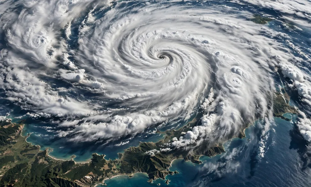
India’s Meteorological Department, known as the IMD, has confirmed the formation of Cyclone Murasu over the Bay of Bengal. The system is being closely monitored while it sits southeast of Chennai, and forecasters say it is expected to strengthen into a severe cyclonic storm.
News of a new cyclone always raises questions for people living near the coast, and for families with relatives in coastal towns and cities. What does the name mean? How serious is a severe cyclonic storm? And what should residents do while the system is still developing? This article explains the basics in plain language, without speculation about exactly where the storm will go next.
It is important to be clear about what is known and what is not yet known. At this stage, the confirmed facts are the formation of the system, its broad position southeast of Chennai, and the expectation that it may strengthen. Details such as a precise landfall location and timing are for official forecasters to update as the storm evolves, and residents should rely on those official updates rather than rumours on social media.
Quick Facts
| Detail | What we know |
|---|---|
| Storm name | Cyclone Murasu |
| Confirmed by | India’s Meteorological Department (IMD) |
| Location reported | Over the Bay of Bengal, southeast of Chennai |
| Expected strength | May strengthen into a severe cyclonic storm |
| Official advice | Follow IMD advisories and local authority guidance |
What Is a Cyclone?
A cyclone is a large, rotating weather system that forms over warm ocean water. At its center is an area of low pressure, often called the eye when the storm is well developed. Around that center, winds spiral inward and upward, drawing in warm, moist air from the sea surface. As that air rises and cools, it forms towering clouds and heavy rain.
Cyclones go by different names in different parts of the world. In the Atlantic and northeast Pacific they are called hurricanes. In the northwest Pacific they are called typhoons. In the Indian Ocean, including the Bay of Bengal and the Arabian Sea, they are called cyclones. The physics is the same, even though the names and local warning systems differ.
What makes a cyclone dangerous is not just wind. Heavy rainfall can cause flooding far inland, even in places that never experience the strongest winds. A storm surge, which is a rise in sea level pushed ashore by the storm, can flood low-lying coastal areas. Large waves, intense rain, and strong gusts together can damage homes, power lines, trees, and crops.
What Does Severe Cyclonic Storm Mean?
The IMD uses a scale to describe how strong a cyclonic system is. The categories move upward as wind speeds increase, from a depression, to a deep depression, to a cyclonic storm, and then to a severe cyclonic storm, and beyond that to very severe and extremely severe stages.
A severe cyclonic storm is therefore a significant step up from an ordinary cyclonic storm. It means forecasters expect stronger sustained winds, heavier rainfall, and rougher seas than in a weaker system. It is a warning that the storm deserves serious attention, even if its exact path is still uncertain.
It is worth remembering that categories describe wind strength at a given time, not the total impact. A storm that stays offshore can still bring heavy rain and rough seas to the coast. A storm that weakens before landfall can still cause flooding. That is why officials look at wind, rain, surge, and local geography together, rather than judging a storm by one number alone.
Why the Bay of Bengal Breeds Such Storms
The Bay of Bengal is one of the most cyclone-prone basins in the world, and there are clear reasons for that. The bay is relatively enclosed, with land on three sides, and its surface waters are often very warm. Warm water is the fuel for cyclones: it supplies heat and moisture that allow a disturbance to grow into a rotating storm.
The shape of the bay also matters. Its funnel-like northern end can push storm surge higher as water is forced into a narrowing space. Low-lying coastal plains and river deltas in the region are especially vulnerable to flooding when surge and heavy rain arrive together. Millions of people live in these coastal areas, which is why even a moderate cyclone can affect a very large population.
Cyclones in this region tend to form in two main seasons: before the summer monsoon and after it, in spring and autumn. During those periods, wind patterns over the bay are more favourable for a disturbance to organize and spin up. That seasonal pattern helps forecasters and disaster managers prepare, but each individual storm still follows its own path and timing.
How Such Storms Are Tracked
Modern cyclone tracking relies on a combination of tools. Satellites watch cloud patterns from space, day and night, and give forecasters a continuous view of a storm’s size, shape, and movement. Weather radars on the coast track rain bands as a storm approaches land. Ships, buoys, and coastal weather stations report wind, pressure, and sea conditions from the ocean itself.
Forecasters feed all of that information into computer models that simulate how the atmosphere might evolve over the next few days. Different models sometimes disagree, especially about exact landfall points several days ahead. That is normal in weather forecasting. As a storm gets closer, observations improve and forecasts usually become more precise.
The IMD issues regular bulletins for systems in the Indian Ocean, updating position, intensity, and expected movement. Those bulletins are the authoritative source for India. Local governments, disaster management agencies, and news outlets then pass that information on, often with added advice about evacuations, school closures, transport, and fishing restrictions when needed.
What Residents in Coastal Areas Should Do
For people in coastal areas, the most important step is simple: follow official advisories. Check updates from the IMD and from local authorities, and act on their guidance about staying indoors, avoiding the coast, or moving to safer ground if an evacuation is ordered. Official advice takes local conditions into account in a way that general social media posts cannot.
It is also wise to avoid speculation. In the early days of a cyclone, online posts often claim a precise landfall place or time long before forecasters can know it with confidence. Sharing unverified claims can cause unnecessary panic or, just as dangerously, false reassurance. If a forecast does not come from the IMD or a recognized meteorological agency, treat it with caution.
Practical preparation, in general terms, includes keeping phones charged, keeping essential documents and medicines in one accessible place, storing drinking water and basic supplies, and securing loose items outdoors that could be blown around in strong winds. Fishermen and others who work at sea should pay special attention to official warnings about venturing out, since seas can become dangerous well before a storm reaches land.
Families should also agree on a simple communication plan: how to reach each other if mobile networks become patchy, and where to meet if local movement is disrupted. These are general preparedness steps for any severe weather event, not specific instructions for Cyclone Murasu, and local authorities may add specific guidance as the situation develops.
FAQs
Has Cyclone Murasu made landfall?
Based on the information in the brief for this article, the confirmed facts are formation over the Bay of Bengal, a position southeast of Chennai, and an expectation of strengthening. No landfall date or district has been confirmed here, and readers should check the latest IMD bulletin for the most current position.
Is a severe cyclonic storm the strongest category?
No. Severe cyclonic storm is a serious category, but the IMD scale goes higher, to very severe and extremely severe cyclonic storms. Strength can also change over time as a storm moves over warmer or cooler water.
Why should people avoid social media forecasts?
Social media posts can mix genuine updates with guesswork, old maps, or images from other storms. Official bulletins from the IMD are based on satellite, radar, and model data, and are updated on a fixed schedule. They are the safest source during a developing storm.
What is the biggest danger from a cyclone?
Wind gets the most attention, but water is often the greatest danger. Heavy rain can cause inland flooding, and storm surge can flood coastal areas. That is why warnings cover rain and sea conditions as well as wind speed.
Final Thoughts
Cyclone Murasu is a reminder of how quickly weather over the Bay of Bengal can become a serious concern, and how important reliable forecasting has become. Satellite tracking, computer models, and regular official bulletins mean that coastal communities now get far more warning than they did a generation ago. That warning only helps, however, if people hear it and act on it.
For now, the sensible approach is calm attention: follow IMD updates, listen to local authorities, avoid speculation, and take general preparedness steps. As the storm develops, official forecasts will become clearer, and this story will be updated by the facts on the ground and in the atmosphere, not by guesswork.